In brief
The essential points
- The most durable Assyrian heartland centred on the upper and middle Tigris around Ashur, Nineveh, Kalhu and Arbela.
- Trade routes, tributary relationships, campaign reach and directly governed provinces are not the same kind of border.
- Modern country names help readers orient themselves, but they should never be projected backward as ancient states or exclusive ethnic territories.
A city, a god and a land
The word Aššur could refer to a city on the Tigris, the city’s principal deity and the country ruled in that god’s name. These meanings were intimately connected but not identical in every text or century. In the Old Assyrian period, civic institutions and the temple anchored a city-state. By the Middle and Neo-Assyrian periods, “Land of Ashur” could describe a territorial kingdom whose governors, farmers, soldiers and subject populations stretched far beyond the original urban community.[1][3]
That distinction matters for modern maps. A dot for the city, a shaded homeland and a line around an empire answer three different questions. The ancient core can be mapped with some confidence; the outer frontier may depend on a particular year, a king’s claim, the status of a vassal or the temporary reach of an army. There was no one permanent outline called “Assyria” that remained valid for two millennia.[2][10]
The Tigris heartland
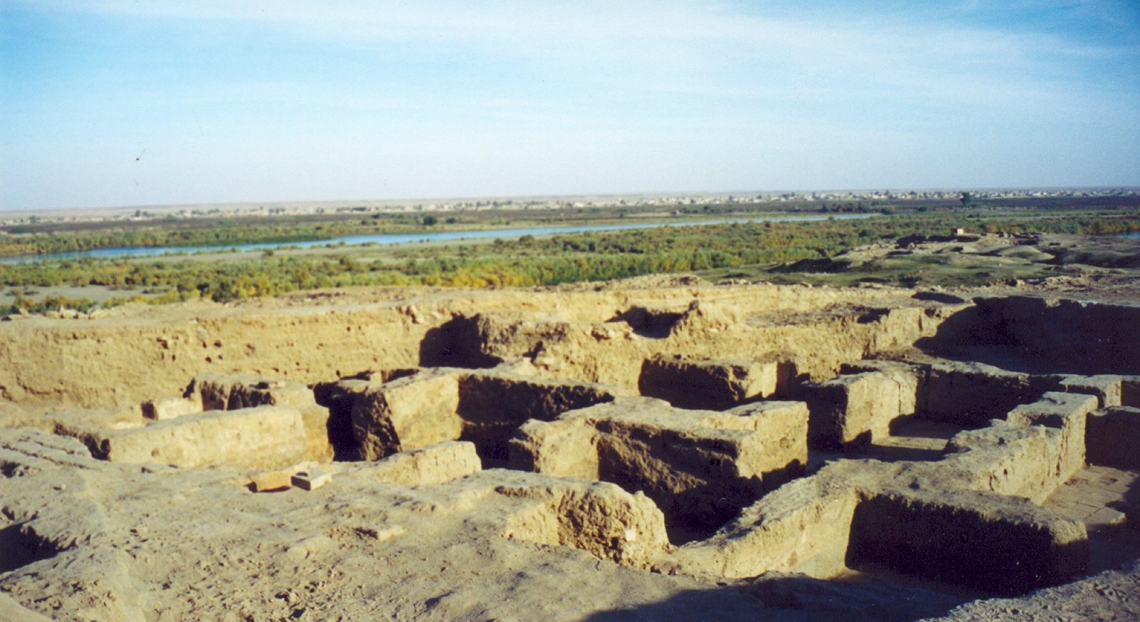
Assyria’s core lay in northern Mesopotamia, principally in what is now northern Iraq. The Tigris flowed past Ashur and connected royal centres farther north. The Great Zab and Lower Zab crossed fertile plains east of the river, while foothills rose toward the Taurus and Zagros. Rain-fed agriculture was more dependable in the north; Ashur sat close to the ecological boundary where irrigation became increasingly important.[4][1]
This position brought opportunity and exposure. Routes led west toward the Khabur and Euphrates, north into Anatolia and east toward the Iranian plateau. Timber, metals, stone, horses and luxury goods moved through landscapes beyond Assyria’s agricultural core. Geography did not mechanically create an empire, but access to river valleys and interregional roads shaped commerce, campaigning, royal construction and the constant need to negotiate highland frontiers.[2][1]
Ashur, Nineveh, Kalhu and Arbela
Ashur was the oldest political and sacred centre. Even after the court moved, coronation traditions, temples and the god Ashur preserved its exceptional status. Nineveh, opposite modern Mosul, was an ancient settlement and cult centre of Ishtar long before Sennacherib made it the principal royal capital. Kalhu, known today as Nimrud, became Ashurnasirpal II’s court city in the ninth century BCE. Its palaces, temples and administrative buildings served the empire for generations.[4][5]
Arbela, beneath modern Erbil, was another major centre associated with Ishtar. Continuous occupation makes its early layers harder to excavate than abandoned mounds. Together these places define a broad north–south and eastward core, but there were many other towns, villages, canals and farm districts. Reducing Assyria to its famous palaces erases the ordinary landscapes that fed and staffed them.[2][1]
Why Assyria had several capitals
Royal residence shifted without cancelling Ashur’s sacred primacy. Ashurnasirpal II expanded Kalhu as a stage for court ritual, administration and reception. Sargon II later built Dur-Sharrukin—“Fortress of Sargon”—as a planned capital with a huge palace platform and walled enclosure. When he died in battle, Sennacherib moved the court to Nineveh and remade that older city on an imperial scale.[6][7]
These moves expressed dynastic ambition and reorganised labour, supply and elite access. They also remind us that a capital can mean several things: a ruler’s residence, an administrative hub, a sacred centre or the symbolic heart of a country. Calling Nineveh “the Assyrian capital” is correct for Sennacherib and his successors, but misleading if applied to Old Assyrian merchants a thousand years earlier.[5][1]
Merchants abroad were not imperial borders
Old Assyrian traders maintained quarters in Kanesh and other Anatolian cities during the early second millennium BCE. Their letters document caravan schedules, commercial courts, local partners and family businesses. The network reached far from Ashur, but those routes should be drawn as lines and nodes, not as a coloured territorial block. Political authority remained with Anatolian rulers, even when Assyrian merchants exercised recognised communal rights.[8][9]
The same caution applies later. Tribute might signal a negotiated relationship rather than a province. A vassal ruler retained a throne under obligations that differed from direct administration. An army could raid or receive gifts far beyond territory held throughout the year. Good maps distinguish the directly governed provincial core, dependent kingdoms, allied or tributary polities and the claimed reach of individual campaigns.[7][10]
How far did the empire reach?
The Middle Assyrian state expanded west across the Khabur toward the Euphrates and north toward mountain zones, but its frontiers contracted after the twelfth century BCE. Neo-Assyrian kings first restored much of that sphere, then annexed territory in stages. By the late eighth century the empire governed most of Mesopotamia and large parts of Syria and the Levant, with changing relations to Anatolian, Arabian, Iranian and Babylonian polities.[1][2]
Esarhaddon’s capture of Memphis in 671 BCE and Ashurbanipal’s intervention at Thebes created Assyrian supremacy in Egypt for a short period. That impressive reach was not uniform or secure; client rulers, garrisons and repeated campaigns were required. A map of maximum extent should therefore be dated closely and should not imply that government in Egypt looked like government in an old Assyrian province beside the Tigris.[7][10]
Ancient places within modern borders
Today Ashur, Nineveh, Nimrud, Khorsabad and Erbil are all in Iraq. Other lands once ruled or campaigned through by Assyrian kings lie in Syria, Türkiye, Iran, Lebanon, Israel, the Palestinian territories, Jordan and Egypt. These country names are useful for orientation and heritage protection. They are not ancient labels, nor do maximal imperial borders define an exclusive modern homeland or political entitlement.[4][1]
Modern Assyrian communities describe a historical homeland across parts of Iraq, Syria, Türkiye and Iran. That living geography overlaps with, but is not identical to, the territory of any one ancient reign. It also has always been shared with neighbouring peoples. A respectful account can name Assyrian attachment to places such as the Nineveh Plains, Hakkari, Tur Abdin and Urmia while stating clearly that modern borders, populations and identities have changed.[11][12]
Evidence trail
Sources and further reading
- Karen Radner. Ancient Assyria: A Very Short Introduction. Oxford University Press, 2015.
A concise scholarly synthesis of Assyrian geography, society and imperial history.
- Eckart Frahm, ed.. A Companion to Assyria. Wiley-Blackwell, 2017.
Specialist chapters covering Assyrian history, language, cities, institutions and later reception.
- Jonathan Valk. Ancient Assyrians: Identity and Society in Antiquity and Beyond. Cambridge University Press, 2025.
A study of Assyrian social categories that cautions against projecting modern identity models unchanged into antiquity.
- UNESCO World Heritage Centre. Ashur (Qal’at Sherqat). World Heritage List, 2003–.
Site history, significance and conservation status.
- Eckart Frahm. The Great City: Nineveh in the Age of Sennacherib. Journal of the Canadian Society for Mesopotamian Studies 3, 2008.
- A. Kirk Grayson and project editors. Royal Inscriptions of Assyria online. Open Richly Annotated Cuneiform Corpus, University of Pennsylvania.
Scholarly editions and translations for Assyrian royal inscriptions through 745 BCE.
- Grant Frame, director. Royal Inscriptions of the Neo-Assyrian Period. Open Richly Annotated Cuneiform Corpus, University of Pennsylvania.
Searchable scholarly editions and translations of royal inscriptions; these texts are royal political compositions, not neutral chronicles.
- UNESCO Memory of the World. The Old Assyrian Merchant Archives of Kültepe. UNESCO.
Overview of the merchant archive from ancient Kanesh.
- Metropolitan Museum of Art. The Old Assyrian Period (ca. 2000–1600 B.C.). Heilbrunn Timeline of Art History.
- Joan Aruz, Sarah B. Graff and Yelena Rakic, eds.. Assyria to Iberia at the Dawn of the Classical Age. The Metropolitan Museum of Art, 2014.
Museum scholarship on Assyrian art, imperial imagery and interregional exchange.
- Naures Atto. Hostages in the Homeland, Orphans in the Diaspora: Identity Discourses among the Assyrian/Syriac Elites in the European Diaspora. Leiden University Press, 2011.
- Sargon George Donabed. Reforging a Forgotten History: Iraq and the Assyrians in the Twentieth Century. Edinburgh University Press, 2015.