Geography through time
Assyria, beyond one border.
Move between two dated reconstructions. Compare the empire’s reach with its ancient core.
824 BCE
At the end of Shalmaneser III’s reign
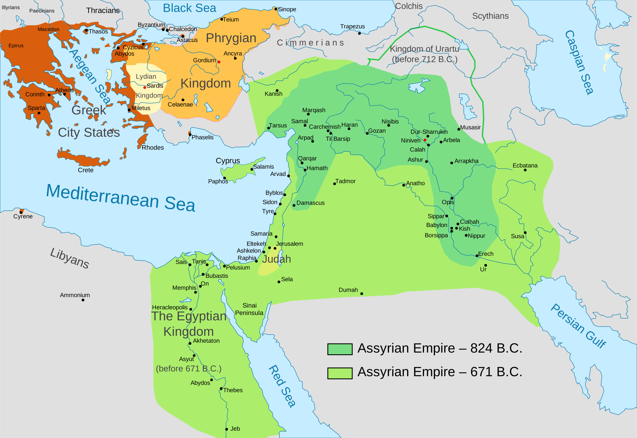
The earlier snapshot shows the broad area attributed to Assyria in the source map at 824 BCE. Expansion under ninth-century rulers re-established control beyond the northern Mesopotamian heartland.
What this map can—and cannot—show
These are approximate historical reconstructions, not surveyed borders, present-day political boundaries or a map of modern ethnic settlement. Imperial influence, military occupation and direct administration were not the same thing. The slider selects the two dates actually represented by the source; it does not imply a continuous year-by-year record.
The dashed core is the same schematic reference area used on our news map, visually aligned to Ashur, Nineveh and Arbela. It is not an additional dated imperial boundary. The geographical drawing follows the source map rather than a modern georeferenced basemap.
Boundary source & reuse
Adapted from Map of the Assyrian Empire by Péter Gulyás, after Renato de Carvalho Ferreira, Rowanwindwhistler and Ningyou, released into the public domain. The source lineage identifies Atlas of the Bible Lands, C. S. Hammond & Co. (1959). Our adaptation isolates the two Assyrian extents, removes unrelated political colouring, restyles the drawing and adds the schematic core and interactive controls. View the unmodified source map.

Historical context
The Metropolitan Museum of Art: Assyria, 1365–609 B.C. provides the overview of expansion and the 671 BCE capture of Memphis. ORACC: Central Assyria explains the heartland around the three principal cities. These contextual sources are not the source of the drawn boundary polygons.